Wind & Thermal Flow
Where your scent actually goes after it leaves your stand — not where you hope it goes.
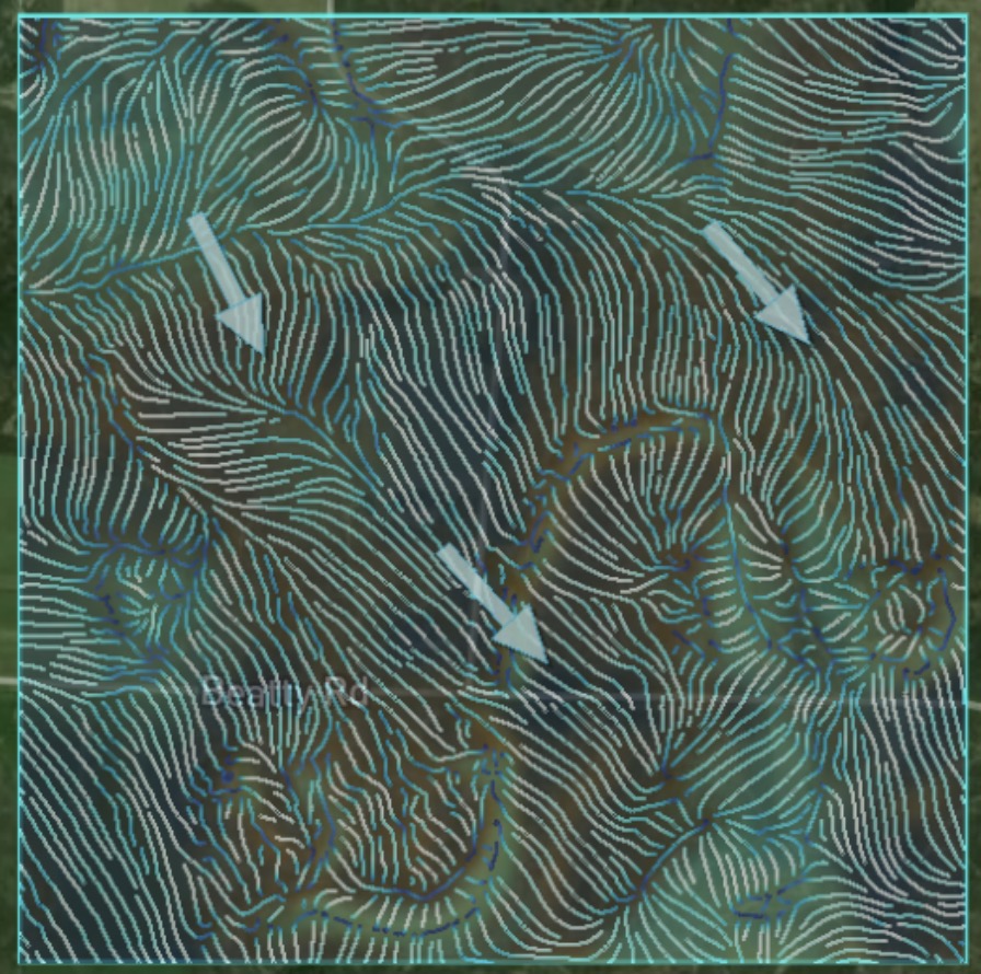
Wind doesn't blow straight through your property. It bends around ridges, stalls in hollows, and pours downhill after dark. HighTine computes a full wind-and-thermal vector field across your actual terrain for all 8 compass directions — real elevation gradient, real canopy drag, real slope-driven thermal drift, layered together into one picture of where scent-carrying air actually travels.
It finds two things that matter most in a stand: lee shadows — pockets tucked out of the wind by the terrain upwind of them — and scent pools, the low, calm, canopy-covered dead spots where cold air and scent settle instead of clearing. Push the wind speed high enough and the model automatically drops the scent-pool overlay, because at that point air is moving too fast for scent to meaningfully pool — showing it anyway would just be lying to you.
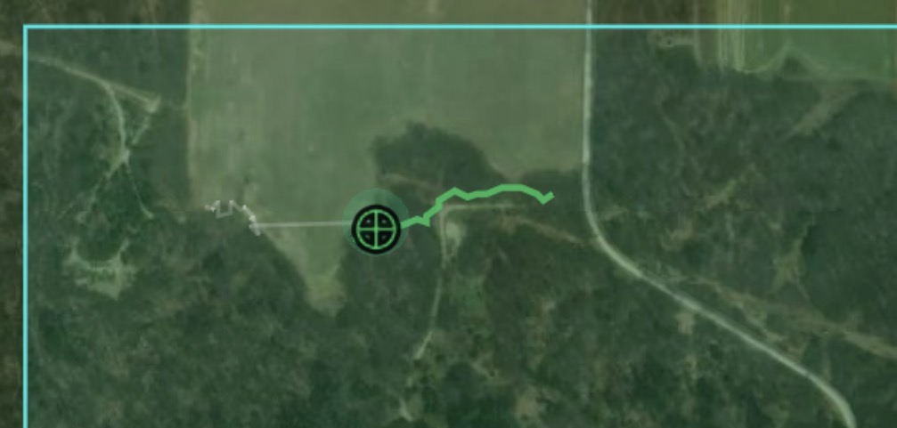
The curling lines on the map aren't decoration. They're a real simulation traced step-by-step through the computed wind field — the actual path scent-carrying air takes across your terrain, including the speed-up you get funneling through a draw and the slowdown climbing a slope.
This is real applied terrain physics — gradient-based deflection, lee-shadow detection, thermal-strength modeling. Not a fluid-dynamics simulator, not machine learning. No Navier-Stokes, no pressure solving. Accurate enough to change where you sit. Fast enough to run on a phone.
Deer Movement
Not where deer could go. Where the terrain says they actually will.
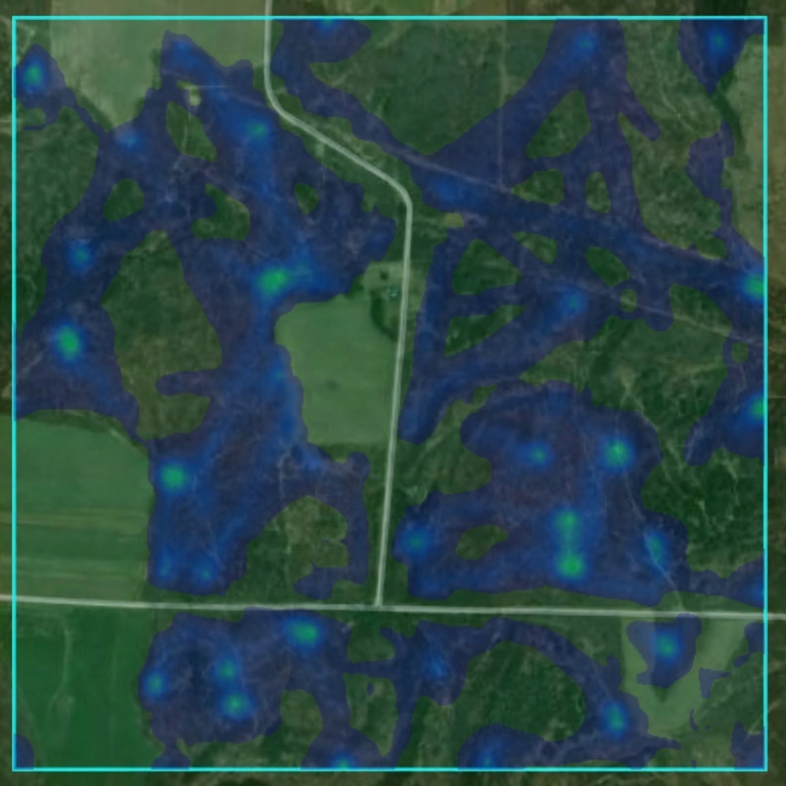
Deer Movement starts by building a security map of your property — not just "where are the trees," but where a deer actually feels hidden. Thick timber and heavy switchgrass score high; thin, open woods score low even with canopy overhead, because visual cover and structure matter more than tree count alone.
From that security map it places four distinct kinds of bedding, not one blob: primary beds get your property's best real estate — benches, ridgelines, northeast-facing slopes, moderate pitch, and the heaviest pressure avoidance in the model. Secondary beds fill in nearby with a lighter pressure penalty. Staging beds sit on cover edges near food, where a deer stops to watch before committing to open ground. Funnel-adjacent beds tuck into the tail end of natural pinch points.
Then it walks — literally. Travel corridors are generated by simulating a path across a real cost surface built from slope, human pressure, cover, ridges, saddles, and benches, biased toward the terrain a deer would actually choose to save energy and stay hidden. Not a straight line between two dots.
Anything you mark yourself gets folded directly into the model, not just pinned on top of it. A confirmed sighting is one of the strongest single inputs in the whole system. A marked bedding location becomes the single heaviest term in how the model scores primary beds nearby. A drawn high-pressure zone can suppress predicted activity in that area by up to 95%.
Deer Bedding
Where the herd beds — does, fawns, young bucks. A different question than where a mature buck beds.
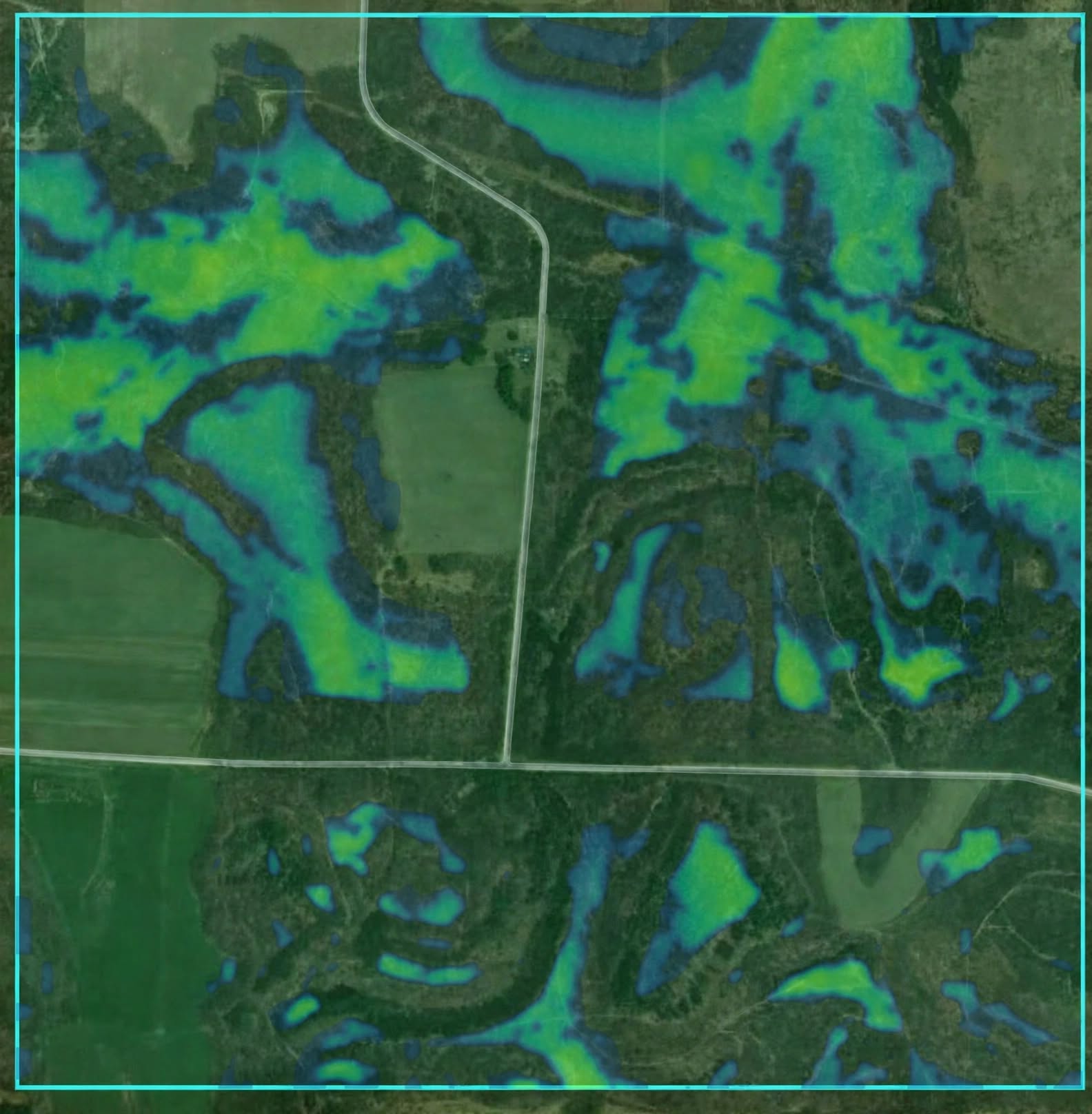
Deer Bedding favors broad, comfortable cover: bedding well inside the interior of timber rather than hugging the edge, drainages and hollows for real thermal shelter, gentle-to-moderate slope, and close range to food.
Every hotspot ships with a written explanation built from the real numbers measured at that exact spot — the actual compass direction the slope faces, the actual distance to the nearest food source, the actual elevation difference from the ground around it. Check the same real-world spot twice and it reads the same way both times. Check two different spots and they never read identically, because the sentence is built from what's actually there, not pulled from a template library.
Buck (Mature Buck) Bedding
A completely separate model — because a mature buck doesn't bed like the rest of the herd.
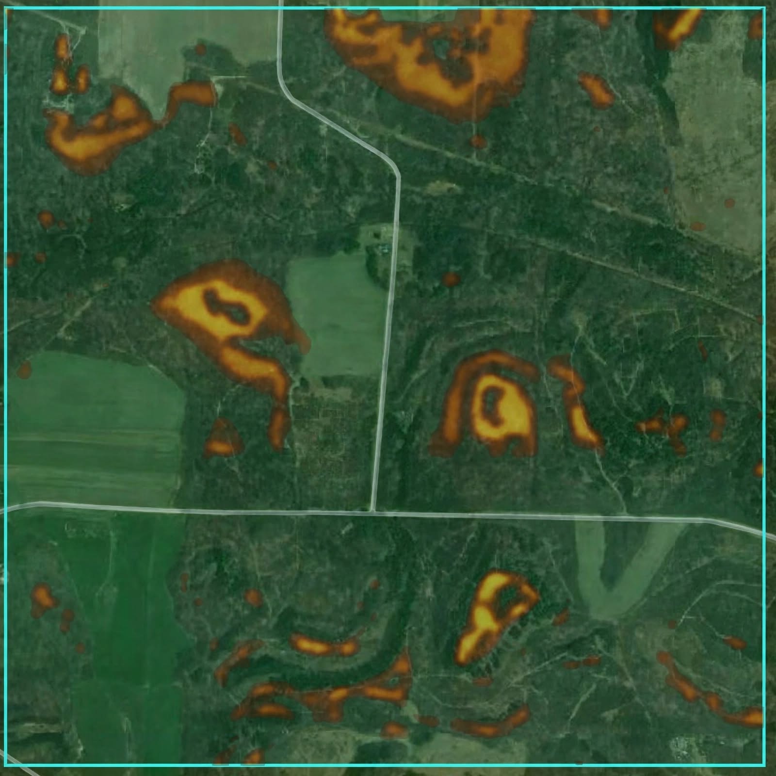
Buck Bedding is tuned to how a mature buck actually beds: alone, defensively, and picky about pressure. It requires the bed to sit in the locally highest half of the surrounding terrain — elevation dominance is the single strongest signal in the model — and weights benches and ridge-adjacent (but not skylined) positioning heavily.
The road and human-pressure buffer is meaningfully wider and harsher than the herd-bedding model's. A mature buck gets penalized far harder for nearby pressure than a doe does — that's not a marketing line, it's a different set of coefficients running under the hood.
On small properties, the model automatically checks a full 1-mile-wide reference area around your land before scoring — so a small analyzed box doesn't manufacture an artificially "hot" bedding zone just because it has less terrain variation to compare against.
Stand Placement
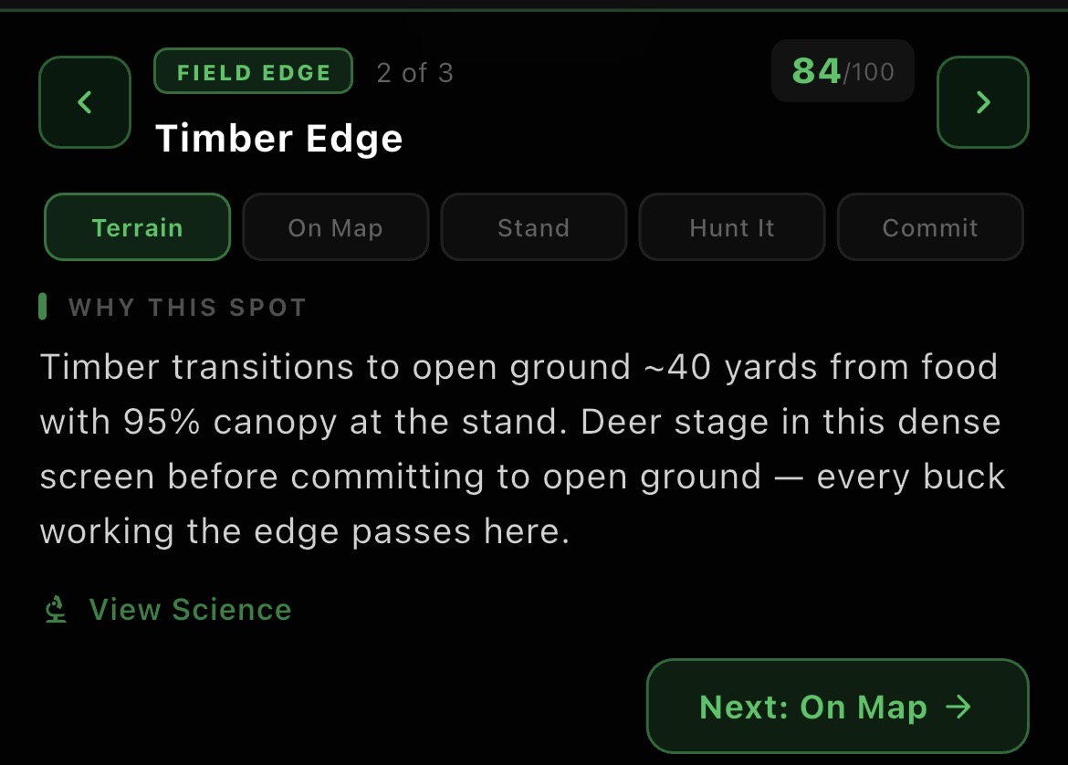
Nine terrain features. Nine real geometric tests. Up to five ranked stands with the science behind each one.
Stand Placement scans your entire property for nine distinct terrain features known to concentrate deer movement — pinch points, saddles, field edges, funnels, benches, drainages, inside corners, ridge points, and glassing points — each detected with its own real geometric test. A saddle is a literal local low point along a ridge. A bench is real flat ground surrounded by real steep ground. A pinch point is cover narrow enough to genuinely funnel a deer through it, not just a random skinny patch of trees.
Every recommended stand comes with the terrain science behind why it works, a realistic hunter-approach route and a separately-modeled deer-travel route — both traced across the real terrain, not drawn as straight lines — an effective-range read that checks real canopy density and real downhill open terrain to recommend bow or rifle, a stand type and height recommendation, a best season and best wind, and a location-specific terrain note pulled from the same real-data-driven writing system used in Deer Bedding.
If you've marked a house nearby or logged a human trail near a candidate spot, it gets thrown out entirely — not docked points, removed from consideration before the model ever ranks its options.
This is the real formula layer — the actual constants, thresholds, and weights behind all five Predict models, straight out of the terrain-analysis engine. For skeptics, competitors, and technical partners who want more than marketing copy.